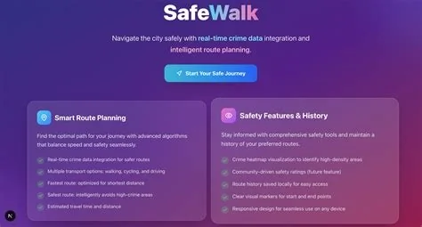
SafeWalk AI is a mobile app that turns publicly available crime data into real‑time safety scores for any walking route you choose. By overlaying a heat‑map on familiar maps, the app lets you see which streets are low‑risk and which ones might need extra caution, helping you plan safer commutes in minutes.
How SafeWalk AI Generates Street‑Level Safety Scores
The team built the platform on an open‑source stack that pulls crime logs from city open‑data portals. Every night a script fetches the latest CSV or JSON files, normalizes fields such as type, location, and timestamp, and feeds them into a lightweight algorithm that weighs incidents by severity and recency.
Data Collection and Normalization
- Automated nightly pulls from municipal open‑data APIs.
- Standardization of incident attributes for consistent processing.
- Filtering of irrelevant entries to keep the dataset clean.
Scoring Algorithm
The algorithm assigns each incident a weight based on how recent it is and how serious the offense was. Those weights are summed for a given street segment and then scaled to a safety index ranging from 0 (high risk) to 100 (low risk). The index updates automatically as new data arrives.
Key Features for Everyday Walkers
- Interactive heat‑map that highlights risk levels along any route you enter.
- Customizable layers for specific crime categories such as theft, assault, or vehicle‑related offenses.
- Push alerts that notify you when a planned route dips below your chosen safety threshold.
- Seamless overlay on Google Maps, allowing you to switch between familiar navigation and safety view.
Impact on Communities and Public Safety
By giving citizens a clear, color‑coded view of local crime trends, SafeWalk AI encourages municipalities to maintain timely, high‑quality data feeds. When residents rely on the app, gaps in reporting become more visible, prompting city officials to improve transparency. At the same time, the app includes contextual notes that explain data confidence, helping you interpret spikes without overreacting.
Future Plans and Expansion
The developers plan to pilot SafeWalk AI in three neighboring municipalities over the next several months, gathering feedback to fine‑tune the weighting model. They’re also exploring partnerships with transit agencies so safety scores could appear directly on bus‑stop kiosks, giving you an extra layer of awareness before you even step onto the street.